
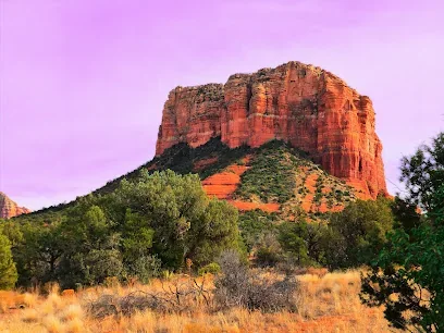
Bell Rock Trailhead
Village of Oak Creek · Access-area reference
WebsiteSedona mountain biking planner
Plan a Sedona mountain-bike day around trail-system character, rider skill and current conditions.
Explore · Interactive destination map
Map markers remain access-area references. Use the separate route list below for seven Visit Sedona rides with published distance and level wording; these are guide descriptions, not a single standardized technical scale.
If the map is unavailable, choose a result below. Map markers are location references, not live conditions.
Village of Oak Creek · Access-area reference
Website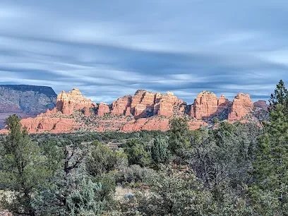
Chapel Area · Access-area reference
Website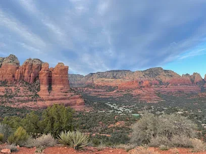
West Sedona · Access-area reference
Website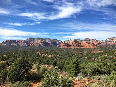
West Sedona · Access-area reference
Website
Oak Creek Canyon · Access-area reference
Website
West Sedona · Access-area reference
WebsiteSeven Visit Sedona Secret 7 guide entries publish ride-level wording and distances. Filter the source wording as written; it is not a standardized technical grade. The guides use different distance bases (round trip, point to point, segment, or unspecified), shown on each card. These entries are descriptions, not route geometry; check Forest Service maps, restrictions and current conditions.
Select rides using the buttons below. Source level wording and distances are guide descriptions, not a standardized difficulty scale or equivalent outing measurement. Check current maps and legal access before riding.
No routes selected
7 published mountain-bike rides
A mostly shaded ride with broad views; optional Cockscomb connection makes a shorter loop.
Sedona area · 5.4 miles round trip · Published level wording: Easy
Visit Sedona lists 2.7 miles each way; the guide also offers a 4.4-mile loop using Cockscomb Trail.
Visit Sedona Secret 7 Biking GuideAn intermediate route above the red rocks; the guide notes it was rerouted to eliminate creek crossings.
Sedona area · 4.5 miles to Snake Trail · Published level wording: Moderately trafficked, intermediate out-and-back
Visit Sedona lists 4.5 miles from Girdner Trailhead to Snake Trail; it also describes 10.7- and 11-mile loop options.
Published full outing: 10.7 miles. One listed loop uses Snake Trail and is 10.7 miles; another uses Anaconda Trail and is 11 miles.
Visit Sedona Secret 7 Biking GuideA technical singletrack with slickrock and drops; use the legal trail connections described by the guide.
Sedona area · 2.7 miles point to point · Published level wording: Challenging, intermediate
Visit Sedona lists 2.7 miles from Bell Rock Pathway parking to Little Horse Trailhead; a 6.2-mile loop is also described.
Published full outing: 6.2 miles. The listed 6.2-mile loop returns via Little Horse Trail and Bell Rock Pathway. The guide warns bikes are prohibited in the nearby Munds Mountain Wilderness.
Visit Sedona Secret 7 Biking GuideA rolling route with slickrock and optional splits; the guide says some riders may need to dismount.
Sedona area · 2.6 miles · Published level wording: Intermediate
Visit Sedona lists 2.6 miles without specifying one-way, round-trip, or loop basis.
Visit Sedona Secret 7 Biking GuideA mostly flowing point-to-point ride with technical portions; the guide advises that non-experts may need to walk some sections.
Sedona area · 6.1 miles point to point · Published level wording: Intermediate / difficult
Visit Sedona lists the route from Aerie Trailhead to Girdner Trailhead.
Visit Sedona Secret 7 Biking GuideA steep climb to views of Red Rock Crossing and Thunder Mountain.
Sedona area · 4 miles round trip · Published level wording: Moderate
Visit Sedona explicitly labels this distance round trip.
Visit Sedona Secret 7 Biking GuideA downhill route on loosely packed soil; the guide notes an optional Pyramid Trail extension adds challenge.
Sedona area · 2 miles; optional 1.2-mile Pyramid Trail extension · Published level wording: Moderate
Visit Sedona lists the Scorpion segment as 2 miles and a separate optional 1.2-mile Pyramid Trail extension.
Visit Sedona Secret 7 Biking GuideBeginner to intermediate
South Sedona and the Village of Oak Creek offer connected riding with route options that can be shortened or extended. Expect rock features and navigation choices even on rides described as approachable.
Intermediate variety
West Sedona connects multiple loops and trailheads near services, bike shops and food. Build a route that matches technical ability instead of using mileage alone; ledges and exposure can make a short ride demanding.
Advanced riding
Broken Arrow, the Hog trails and other advanced routes may involve steep rock rolls, exposure and difficult line selection. Riders should use current trail maps, respect directional guidance and walk features that exceed their comfort.
Trail care
Rain can make Sedona trails vulnerable to rutting. After storms, confirm conditions with local shops or land managers and choose a durable alternative when surfaces are soft.
Current-source checklist
Route descriptions do not show every temporary closure, saturated surface or new restriction. Use official maps for legal access, ask a local shop about recent trail conditions, and turn around when technical features exceed the group’s ability.
Detailed activity planning
Sedona riding can combine ledges, rock rolls, exposure, tight turns and route-finding within a short distance. Choose lines for the least experienced rider, walk features without pressure and carry tools appropriate to the equipment. A rental does not make an advanced route suitable.
Use a current map and understand where bicycles are prohibited, including wilderness. Stay on the designated route and yield according to posted guidance.
Wet clay can hold ruts and damage the trail long after a storm. Ask the land manager or a local shop about recent conditions and choose a durable road, skills area or non-riding activity when surfaces are saturated.
Heat, lightning, wind and winter ice affect riders quickly. Carry more water than the mileage suggests and keep a conservative return margin.
Confirm bike size, suspension setup, helmet, repair kit, battery range for an e-bike, damage terms and return deadline. Know whether the selected route allows the class of e-bike being used. Save the shop contact and keep the ride within the group's repair and navigation ability.
Cell service is not guaranteed. Share the route and expected return with someone who is not on the ride.
Control speed near hikers, horses, homes and blind corners. Announce passes, avoid skidding and do not build unofficial bypasses. Park legally and keep the trailhead clear for emergency access.
A respectful ride protects both the trail and continued access.
Technical fatigue, heat and navigation errors often appear on the return. Build the route so difficulty and exposure do not increase after the group is committed. Confirm bailout connections on the same current map used for the primary line. Leave time for equipment return and cleanup, and do not schedule a distant reservation immediately after a condition-dependent ride. If surfaces are wet, use the planned non-riding alternative instead of searching for an unofficial dry line.